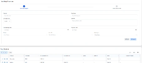
New Project Definition
The project name, code, location, start and end dates, and responsible team information of urban transformation projects are defined through the system.



Urban Transformation Management
A GIS-based urban transformation platform for the integrated management of project areas and spatial data.
OverviewExplore
Map, Format Support, Detailed Reports, Integration Compatibility, and Regulatory Compliance are all managed within the same corporate structure.
Overview
The Urban Transformation Software is a web-based, GIS-integrated automation system developed to manage all the work and operations of risk areas, reserve building areas, and transformation projects carried out by municipalities on a single platform.
Capabilities
Core Competencies
Property management, rightful ownership, application, distribution, settlement, rent placement, payment, correspondence, and report processes are managed together in an Enterprise Resource Planning+GIS structure.
Go to OverviewProperty records entering transformation and those formed after transformation are tracked in a single inventory together with title deed and technical information.
Owner, rightful owner, and application information is managed together with documents; each record in the process is tracked on a project basis.
Distribution scenarios, offer processes, and settlement records are carried out in a controlled way; decisions become traceable.
Rent assistance, placement, payment plans, and progress payment processes are tracked in connection with the project schedule.
Official correspondence, minutes, outputs, and corporate reports are produced with the current data of the transformation process.
Project area, parcel, building, and rightful ownership data is located on GIS; it works together with operational records.
Capability Cards
The main modules from the documentation were organized as corporate summary cards.
The project name, code, location, start and end dates, and responsible team information of urban transformation projects are defined through the system.
The title deed and technical information of the blocks, parcels, and independent units included in the transformation scope are recorded in the system, creating the project property inventory.
The title deed and technical data of the properties produced or removed from scope at the end of the transformation process are updated; inventory integrity and process traceability are maintained.
The Adding a New Building area lets you track, control, and manage the related process from a single screen in line with corporate workflows.
The New Building Detail Information area lets you track, control, and manage the related process from a single screen in line with corporate workflows.
The Settlement Management area lets you track, control, and manage the related process from a single screen in line with corporate workflows.
The Map Operations area lets you track, control, and manage the related process from a single screen in line with corporate workflows.
The Map-Based Property Display and Matching area lets you track, control, and manage the related process from a single screen in line with corporate workflows.
Resources
Access presentation and promotional content about Urban Transformation Management from this area.
Product Tour
The project name, code, location, start and end dates, and responsible team information of urban transformation projects are defined through the system.
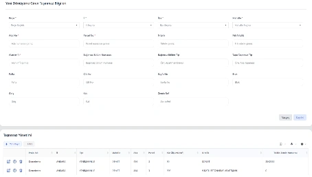
The title deed and technical information of the blocks, parcels, and independent units included in the transformation scope are recorded in the system, creating the project property inventory.
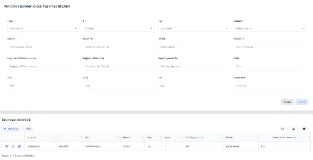
The title deed and technical data of the properties produced or removed from scope at the end of the transformation process are updated; inventory integrity and process traceability are maintained.
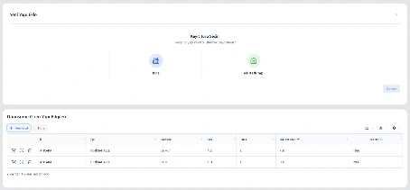
The new building to be constructed in place of the existing one is defined in the system with information such as province, district, neighborhood, block, parcel, total area, and year of construction.
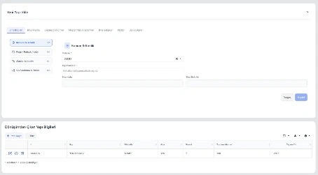
The location, identity, technical information, project and permit data, independent units, and building documents of the new building are managed through a tabbed structure.
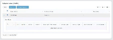
In the offer and settlement processes carried out with the owners, owner information, parcels, land share, share ratio, and offer amounts are recorded.
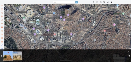
Property, building, and parcel data of urban transformation projects are displayed on a map basis; they are analyzed with layer management, querying, drawing, measurement, and filtering tools.
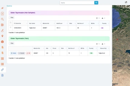
Properties entering transformation and those produced after transformation are compared on a map basis. Rightful ownership, parcel, net area, block, and independent unit data are analyzed with spatial verification.
FAQ
The product's core use cases and corporate contribution are summarized here.
Get in TouchUrban Transformation Management
The Urban Transformation Software is a web-based, GIS-integrated automation system developed to manage all the work and operations of risk areas, reserve building areas, and transformation projects carried out by municipalities on a single platform.